geoBee Models
geoBee Models
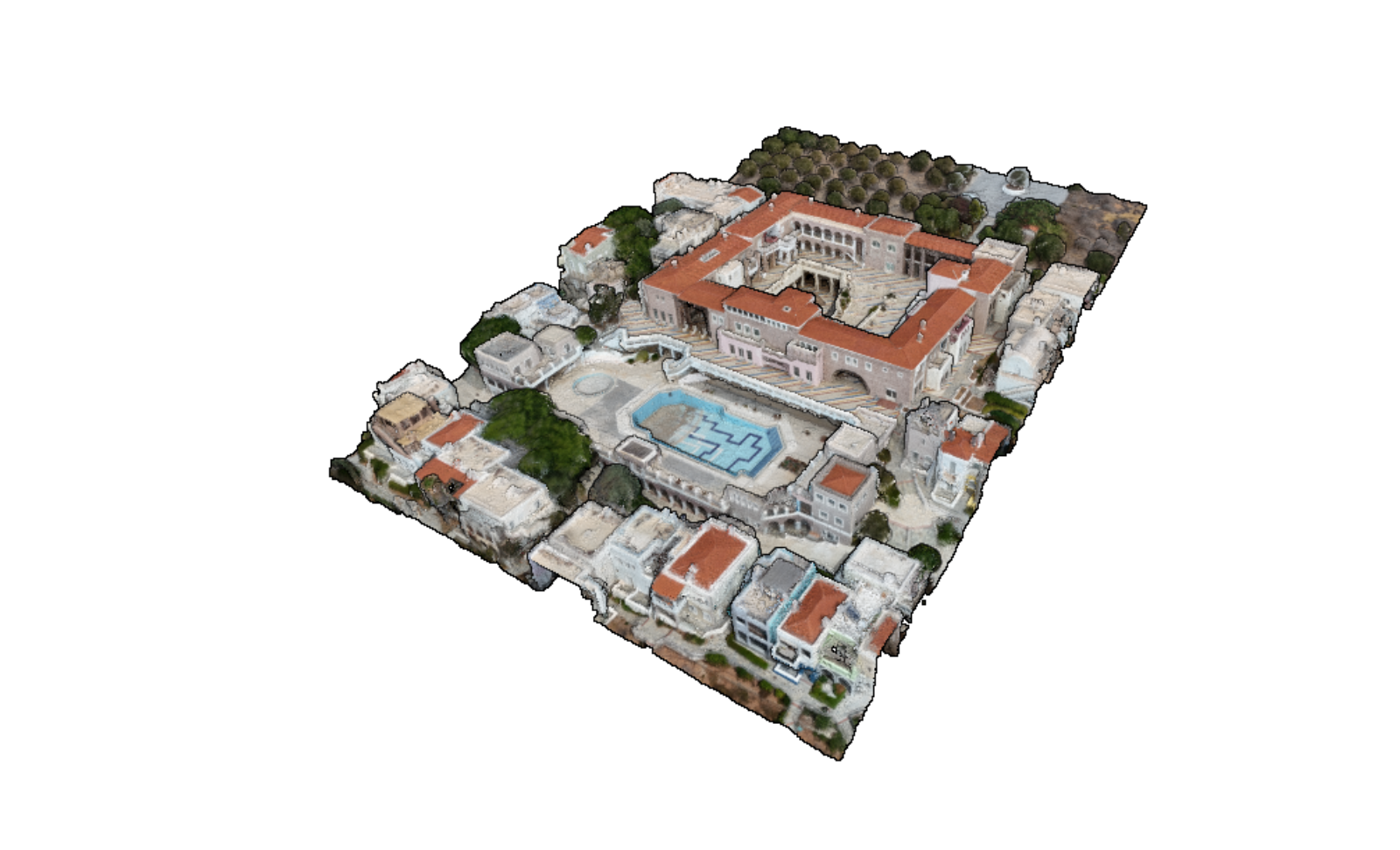
are realistic digital 3D representations of real-world sites
are created from data captured from real-world sites
are available directly in the browser
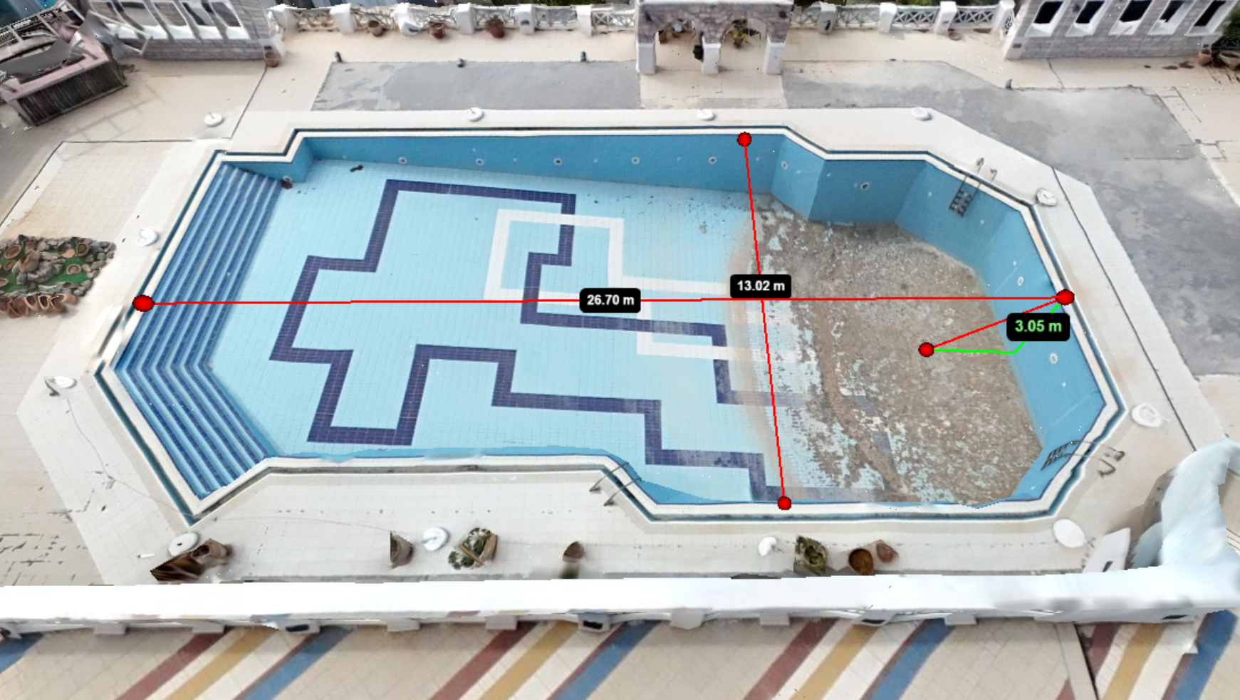
enable remote inspection, measurement and analysis of real-world sites
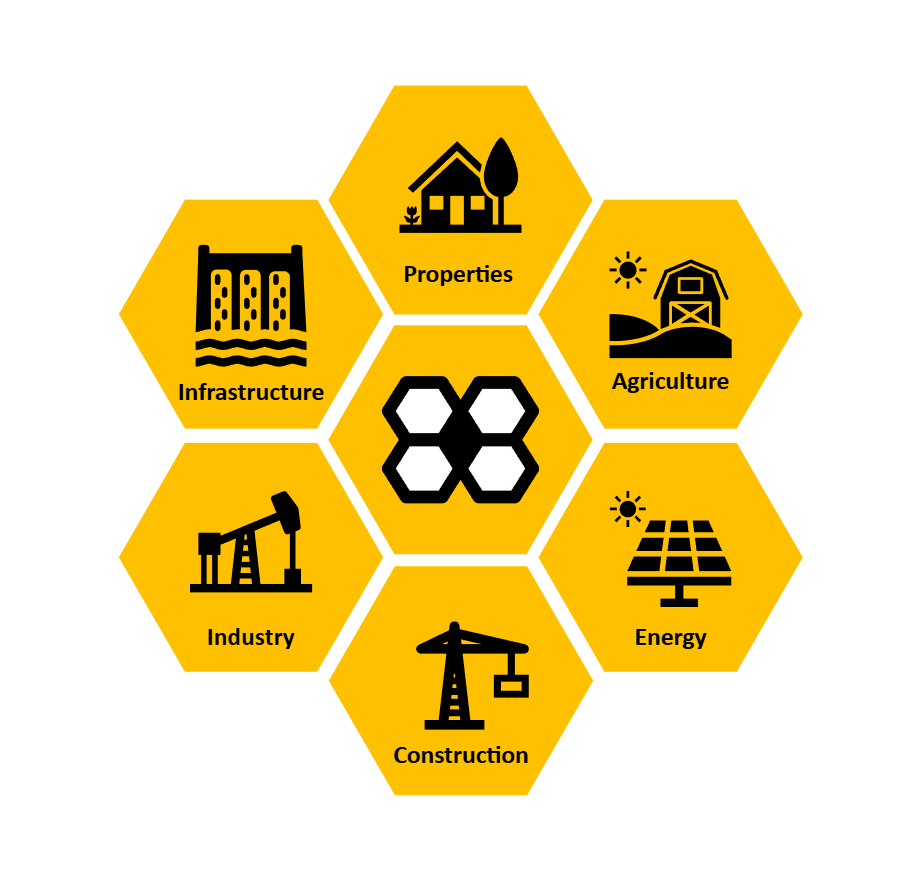
Use cases
Let's say you own a vacation villa somewhere in Greece, and you want to renovate and rent it. Unfortunately, you are currently someplace else, and won't be on-site for the next couple of months. How do you prepare for the renovation? What tools can you leverage?
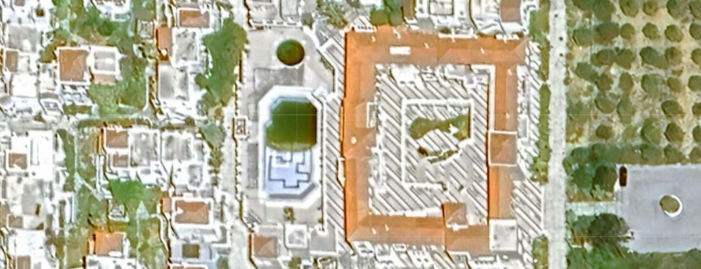
Maps and data available on Google Maps, Google Earth and elsewhere are usually low-res and 2-dimensional, allowing only very basic inspections and interactions:
geoBee models and data offer high-res, 3-dimensionality, and extended inspection, measurement and analysis capabilities:
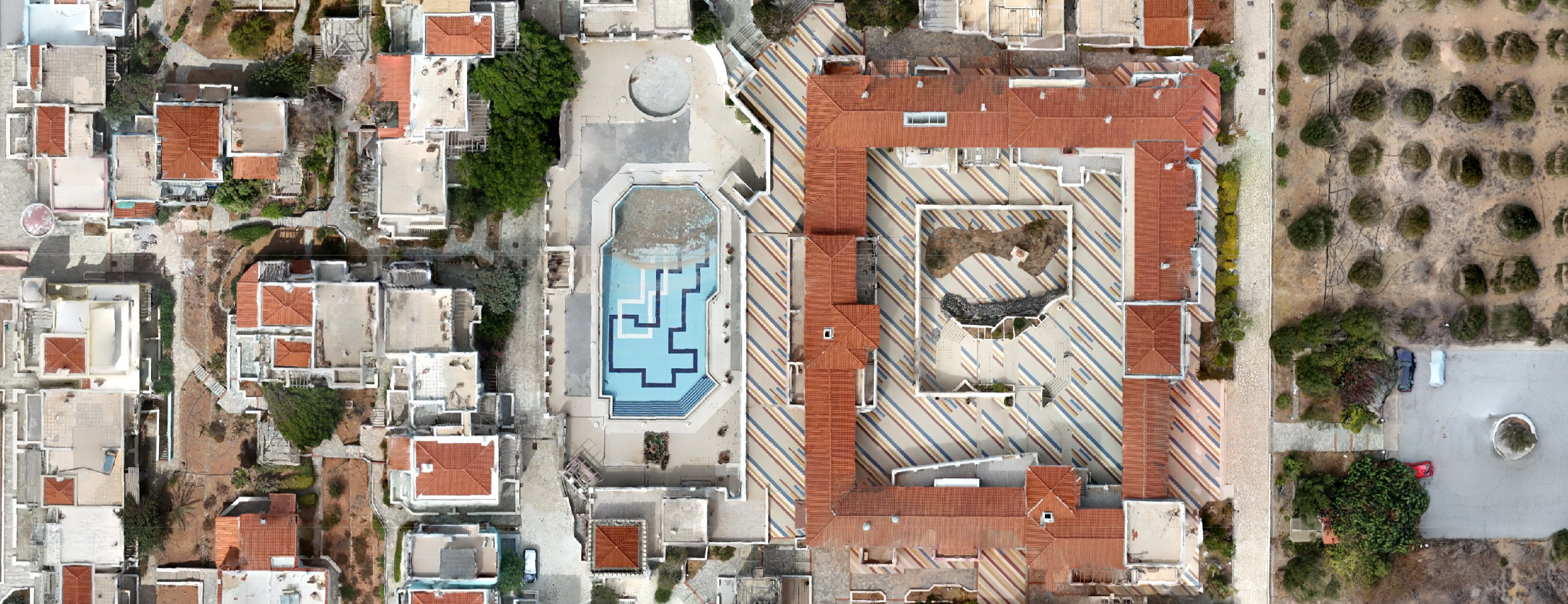
View the high-res map of your site
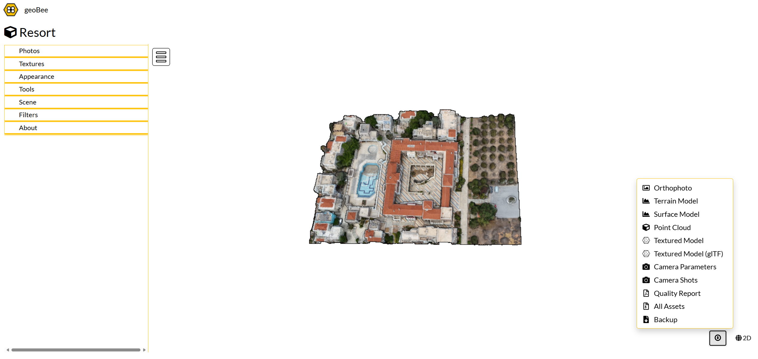
See the geoBee services